
STORY CREDITS
Writer/Editor: Shivangi Vasudev Bhatt
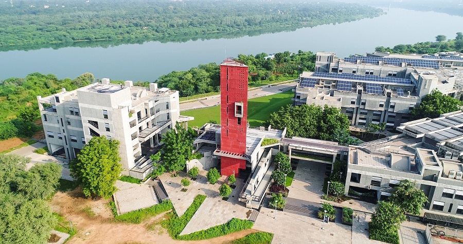
Photo: Media and Communication, IIT Gandhinagar
In the face of increased incidences of erratic weather and resultant flooding in rapidly urbanising cities, effective urban flood management strategies have become both a challenge and an urgent requirement. While many large cities around the world, including India, have employed alternative solutions like Green Infrastructure (GI) interventions, its effectiveness in mitigating urban flooding and water logging during torrential rains remains a puzzle.
In a collaborative effort to find data-backed scientific answers to this critical challenge and role of popular alternative flood adaptation measures, a joint research conducted by Ms Angana Borah (a PhD student) and Prof Udit Bhatia from the Department of Civil Engineering at the Indian Institute of Technology Gandhinagar (IITGN) and Prof Ronita Bardhan from the University of Cambridge, United Kingdom, has revealed that contrary to the current and widely adopted perception, benefits of uniform Green Infrastructure interventions for urban flood management are marginal. The findings of this study underscore the necessity for location-specific models or Green Infrastructure solutions and enhancing conventional urban drainage infrastructure to mitigate the risk of urban flooding during excessive downpours.
According to Prof Ronita Bardhan, “Pragmatic urban greening solutions for climate action is critical in Indian heritage cities as they are cauldrons of traditions and culture which can disappear in the changing climate.”
The study has been recently published in the International Journal of Disaster Risk Reduction by Elsevier: https://www.sciencedirect.com/science/article/abs/pii/S2212420923005551
How the study was done:
The research team chose the west zone administrative division of the Ahmedabad Municipal Corporation (AMC) in Gujarat, a rapidly growing metropolitan city with historical relevance and India’s first UNESCO World Heritage City, to conduct the study. Despite having stormwater drainage infrastructure coverage of 55% in the area under AMC, Ahmedabad has experienced severe flooding in the past few years owing to the monsoon rains. Rapid urbanisation, in conjunction with climate variability in recent times, has significantly escalated rain-related flooding risks, affecting both the economy and daily life in a city historically not prone to flooding.
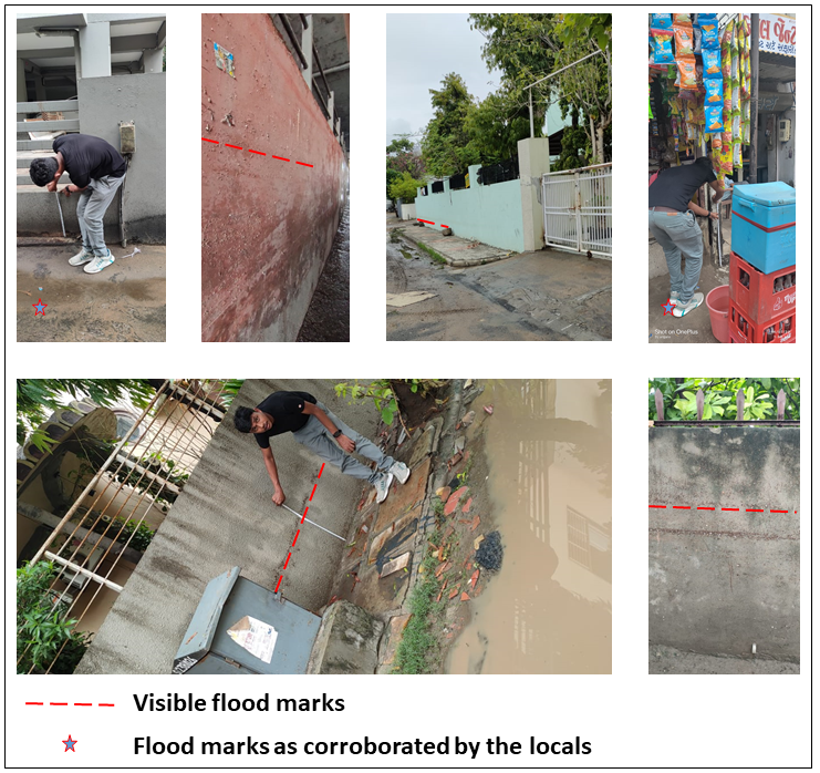
The team carried out comprehensive field surveys using a hydrodynamic model* after major flood events in various areas of the west zone of Ahmedabad a day after the flood levels receded while leaving flood marks on the walls of various residential areas and public infrastructure, such as pillars of overbridges, to measure the flood levels caused by heavy rainfall. The study also integrated high-resolution remote sensing data from satellites to validate the model. This specific method of urban flood modelling, particularly concerning Green Infrastructure adaptation, is a novel and pioneering endeavour in the Indian context and can be used to analyse urban flood management interventions in any densely populated city.
Types of Green Infrastructure evaluated under the study and their effectiveness in flood management:
The research investigated four types of Green Infrastructure in Ahmedabad, namely 1) Green-roofs, 2) Permeable Pavements, 3) Bio-retention Cells, and 4) Vegetative Swales. These are engineered structures designed with multiple layers of soil for the purpose of growing vegetation while also aiding retention, infiltration, and evapotranspiration, essential for the reduction of flood peaks and flood extents. The team evaluated and quantified the efficacy of these Green Infrastructure interventions based on rainwater runoff reduction factors, flood extent, and peak flood depth metrics. After carefully scrutinising the study area, the researchers used several metrics to compare the advantage/efficacy of one Green Infrastructure with another regarding their ability for peak flow reduction and flood volume reduction.
The findings show that even at a 24% application rate per sub-catchment area, Green Infrastructure interventions such as Green Roofs and Permeable Pavements do not exhibit a significant impact on peak flow, which contrasts with earlier studies suggesting flood volume reductions upto 96%.
The results underscore an essential point that the reduction in flooded areas does not directly result in a decrease in peak flood depth within the zones. This highlights the importance of considering variations in flood characteristics, such as depth and extent, when evaluating the efficacy of flood management strategies.
Explaining the significance of this work, Prof Udit Bhatia, Assistant Professor of Civil Engineering at IITGN, said, “With accelerating urbanisation, flood risks are becoming increasingly pervasive. This study highlights the necessity for location-specific models that critically evaluate the effectiveness of flood mitigation strategies such as Green Infrastructure. Universal solutions are ill-suited to address the unique challenges posed by rapid urban growth and climate change.”
The results of this study reinforce the need to strengthen and expand our cities’ existing stormwater drainage systems to counter urban flood crises instead of relying on alternative pathways like Green Infrastructure.
Discussing the mainstream solution for this urban challenge, Prof Udit Bhatia says, “As cities grapple with the increasing incidence of urban flooding, conventional drainage systems, once the backbone of urban flood management, are frequently overwhelmed. This inadequacy is compounded by two critical factors: the rapid and extensive urbanisation that modifies land topography and disrupts existing drainage patterns and the escalating pressures from climate variability and change. Together, these forces render traditional infrastructure insufficient. And hence, we need to strengthen the conventional urban drainage systems and augment them along with green infrastructure solutions to ensure improved resilience against flooding and further environmental changes.”
*What is a hydrodynamic model?
A hydrodynamic model is a mathematical tool that explains the flow of water in any given system such as rivers, lakes, or floodplains and cities using theories of conservation of mass and momentum.
This news has been covered by some of the leading Indian newspapers and media agencies. Click on the links below to read more.